Japanese / English
The 2002 year
Evaluation:
Attendance and reports.
Information:
This course will be opened from 26th to 30th in August as an intensive course.
Morning and Afternoon lessons will begin
at 10:00 and 13:00 everyday.
Class room is seminar room 2 of Biochemestry
and Engineering Building.
This exists over bicycle-parking space facing
main road.
The first half is carried out by Dr.Kazama
and the other is by Prof. Sawamoto.
To registry, please come to Prof. Sawamoto
and hand a registration card to him before
May.
Any question is welcome! ...
E-mail address is here.
Purposes:
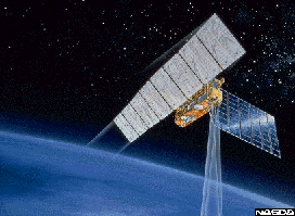
Satellite is very useful for observations
of ground surface but also water quality,
air pollution, mineral resources and human
activity in earth. Theory, application, history
and usage are explained in this course.
Schedule:
1st Introduction
2nd Visible and Infra-red sensor
3rd Micro wave sensor
4th Platform (
5th Data correction, Atmospheric effect
6th Image processing I Geometric correction
7th Image processing II Filtering and extraction
of information
8th Classification and discrimination
9th Application with GIS, -Inland-
10th Application, -Water body and atmosphere-
11th
Reference book:
Thomas M. Lillesand and Ralph W. Kiefer,
Remote Sensing and image interpretation,
John Wiley & Sons, Inc.
Assignments:
I. Get and analyze remote sensing data from
Internet.
II. Search and report the future schedule
of satellite earth observation.
The deadline is 17:00 on September
13th. Submission can be accepted before 20th,
Sep.
Query concerning assignments are welcome.
平成14年度
注意:
この講義は補講期間中に集中講義として行われます.登録を澤本教授まできて申請してください.
講義実施は,8月26日から30日の午前10時から,午後1時から行います.
場所は化学演習室2です.本棟左側駐輪場の右の上です.
前半を澤本が後半を風間聡が行う予定です.
随時,案内を出す予定です.
質問は気軽にメールでどうぞ.
目的:
人工衛星をプラットフォームとするリモートセンシングの原理とその応用について,衛星計測の歴史,リモートセンシングの原理,衛星計測の応用,衛星によるこれからの地球観測の各項目について講義する.
予定:
第1回 序論
第2回 可視,赤外波センサ
第3回 マイクロ波センサ
第4回 プラットフォーム
第5回 データ補正,大気補正
第6回 画像処理I,幾何補正
第7回 画像処理II,フィルターと情報抽出
第8回 画像と情報の分類
第9回 応用とGIS(陸域)
第10回 応用(水域,大気)
参考書:
教科書として以下を用いている.
図解リモートセンシング 日本リモートセンシング研究会編 社団法人 日本測量協会
3,500円
課題:
I. インターネットから実際に衛星データを取得し,解析してみる.
II. インターネットで,衛星を用いた地球観測についてのこれからの計画を検索し,まとめる.
締切: 9月13日(金)17:00.9月20日以降は受け付けない.
課題に関する質問等は何でも受けつけます.